Satellite positioning on a phone is usually accurate to a few metres — fine for navigation, but not for engineering or land records. Differential GPS (DGPS) brings that down to centimetre level, which is why it is the backbone of modern surveying.
How DGPS works
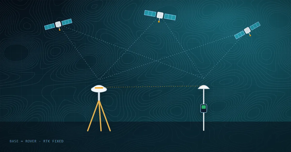
A base receiver is set up on a point with known coordinates. Because it knows exactly where it is, it can calculate the error in the satellite signals at that moment. Those corrections are applied to the rover receiver that the surveyor carries from point to point — removing most of the common errors caused by the atmosphere and satellite orbits.
Static, RTK and PPK — what is the difference?
- Static survey: receivers record data at fixed points for a longer period and are processed afterwards. Used for establishing high-accuracy control points.
- RTK (Real-Time Kinematic): corrections are sent from the base (or a reference network) to the rover in real time, so the surveyor gets accurate coordinates instantly in the field.
- PPK (Post-Processed Kinematic): rover data is corrected later in the office using the base station data — useful where a live correction link is unreliable, and widely used with mapping drones.
CORS networks
A Continuously Operating Reference Station (CORS) network provides correction data from permanent base stations. The Survey of India operates a CORS network, which lets surveyors obtain accurate positions without setting up their own base on every project.
Why Ground Control Points (GCPs) matter
A drone's onboard GPS is not precise enough on its own to produce survey-grade maps. GCPs are clearly marked targets on the ground whose coordinates are measured with DGPS. During processing they anchor the photogrammetric model to real-world coordinates, correcting scale, position and elevation.
- Distribute GCPs evenly across the site, including the edges and elevation changes
- Keep some points aside as check points to independently verify accuracy
- Use high-contrast, well-visible targets that the camera can identify clearly
Learn DGPS surveying hands-on
TGSPL runs practical DGPS / DGNSS survey training covering static and kinematic modes, GCP establishment and post-processing, taught by former Survey of India officers. Need DGPS work for a project instead? See our survey services.